SPANISH PEAKS & Wahatoya RIDE CAMP
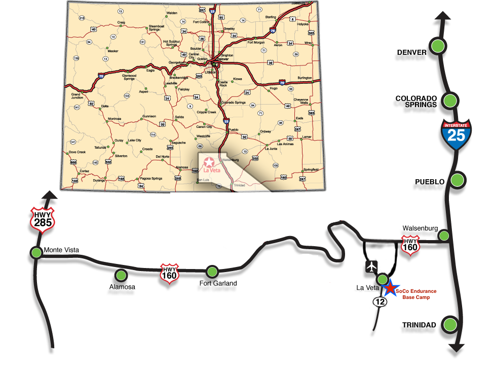
The following link will get you to our first SoCo Endurance Ride Camp SIGN. I recommend taking Hwy 12 all the way to Cuchara street and turning East up the hill (Cuchara Street is a dirt road, and not as steep as Birch.)
Click here for Google Map Link To the first SIGN
The signs are at each turn, so stay on course till you are prompted to turn. CR 360 jogs at 90 degree angles several times as it works it way South toward the peaks. Camp is roughly 10miles from town on county roads. Our signs look like this..

Note! From I-25 please drive all the way to Walsenburg and then take Hwy 160 West ALL THE WAY to Hwy 12, which takes you South to La Veta. DO NOT try to short cut from Walsenburg or Trinidad on county roads to get to camp the back way unless you are looking for an 4×4 adventure.
Click here to map the actual ride camp location… DO NOT use this until you are already in La Veta, or it will take you on back roads!!!
Health Certificates: Use this address – CR 363, La Veta, CO 8105
GPS Coordinates: 37°27’46.2″N 104°57’21.8″W

Click on any of the below guidance images for better view of what you’ll be looking for when you get to La Veta!


